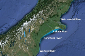
I attribute most of my fascination with the Murray-Darling Basin and its union of rivers and their catchments, to the fact I was born in the South Island of New Zealand. The rivers of the South Island were pretty easy to get your head around – directionally-speaking. Rain tends to fall along the spine of the island, the Southern Alps, gather in small creeks and streams, and then flow in a relatively straight line out to sea, particularly on the east coast. Not to say these wide, braided rivers aren’t fascinating themselves with interesting fluvial dynamics and specially-adapted fauna like the wrybill, but they were my baseline, my ‘normal’ – rivers flow by the shortest route to the sea.
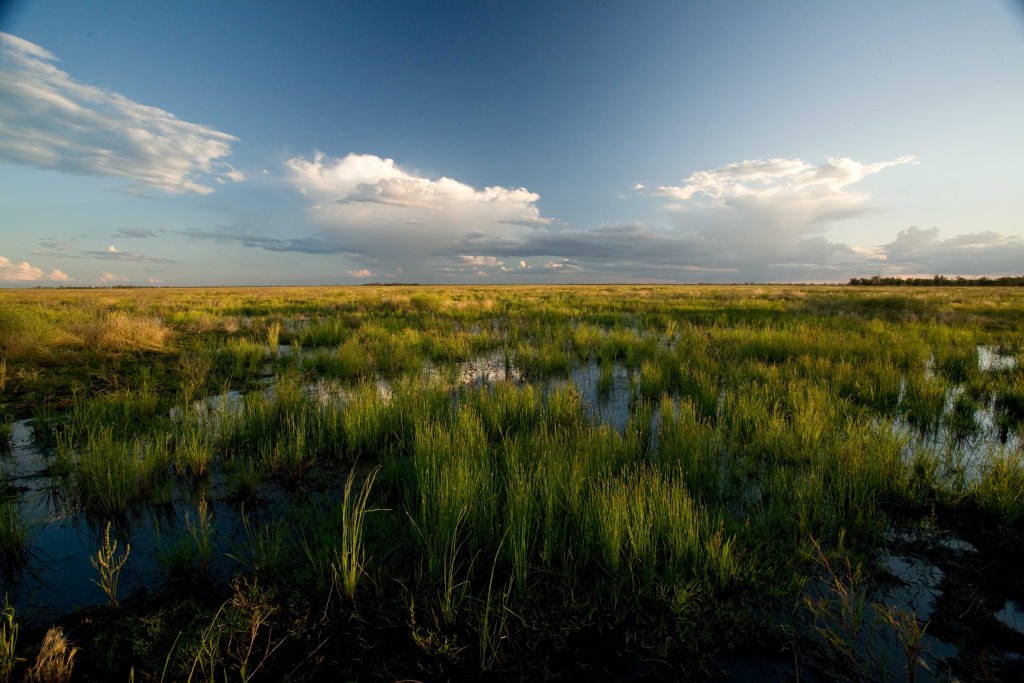
So, imagine the look of amazement on my face, as I stood in the Macquarie Marshes, a large floodplain wetland in the Murry-Darling Basin, early into my first field season and finally figured out where the water was coming from and where it was going. And it wasn’t in a straight line out to the ocean. I’d finally stopped scrutinising the ground for frogs for long enough to think at a landscape-scale, and start piecing together the direction and movement of water in the Macquarie catchment and its connections to the whole Basin.
The Marshes are in the Macquarie-Castlereigh catchment in the middle of the Murray-Darling Basin. This Basin extends over 1 million sq km in south east Australia and most of that is only 200 m above sea level. The headwaters of most rivers, including the Macquarie, are in various parts of the Great Dividing Range where the rain has the temerity to fall on the west side of these ‘mountains’ and to flow – slowly – away from the nearest ocean. That was enough to make me stop and think, ‘crikey, that’s a bit different’.
But then I consulted a map and found the water keeps going north of the Marshes for another 80 km, then joins up with the Barwon River which is going directly west for about 100 km, even further from the sea and then it joins the Darling River, finally heading in a south-west direction towards the Southern Ocean, via the Murray River (see animation below for what that looks like on a map). And because the opening to the ocean is only 200m lower than where I was currently standing, about 1000 km away, that water got there very VERY slowly and sometimes it doesn’t get there at all. For someone with my South Island rivers-baseline, figuring this out was a revelation. And it kick-started my appreciation for the utterly fascinating flow-ecology relationships that exist between the movement of water and the frogs, birds, fish, vegetation and everything else in this massive river basin.
I’m not saying I know all there is to know about the Basin. In fact, after five years and working in two different catchments, I’m more aware of how much I don’t know. But I still have my curiosity and fascination. And I still stand in wonder when out in the Marshes or the Lowbidgee wetlands, looking at the flat, flat horizon. That is when I’m not scanning the ground for frogs.